In September this year, Amazonas, the state home to the world’s largest hydrographic basin, recorded the lowest percentage of surface covered by water since 2018. The data was released on Monday (16) in a technical report by the MapBiomas project. It was prepared based on the analysis of satellite images from 2018 to date.
The reduction recorded between 2022 and 2023 was almost 14,000 km², an area larger than Amazonas' capital city, Manaus, which has 11,000 km². In September, the part of Amazonas state covered by water dwindled by 40% compared with September last year, when it was recorded the largest area covered by water since 2018.
Amazonas is the epicenter of the severe drought affecting the Amazonian region. Riverside dwellers, Indigenous peoples, extractive people, quilombolas and urban populations reported difficulties fishing and obtaining water and medicines. The state government declared a state of emergency and, with federal support, is sending humanitarian aid to these above-mentioned populations.
In recent weeks, dramatic images of fish and Amazon River dolphins dead, plus isolated communities destroyed by landslides, showed the damages caused by the drought, which were obvious also in the satellite images released by MapBiomas.
"The effects of the severe 2023 El Niño and the warming of the North Atlantic have been considered as the main factors contributing to the severe drought in the Amazonian region, which could be of greater intensity than the 2010 drought [the year of the worst drought in the state's history]," wrote researchers Bruno Ferreira and Carlos Souza Jr, who signed the study.
The Negro River reaches its lowest level in history
On Monday (16), the Negro River recorded its lowest level since measurements began. According to the Port of Manaus, the river recorded a tide of 13.59 meters. It is the lowest since 1902, when measurements began to be taken.
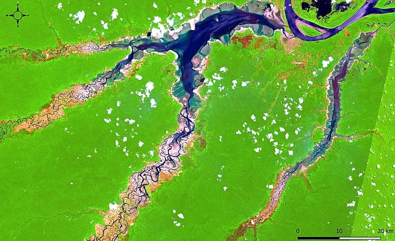
Researchers at MapBiomas also identified areas severely affected by the reduction of the water surface, including the drought in the Tefé Lake, which resulted in the death of over 100 Amazon River dolphins.
Satellite images reveal that entire lakes have dried up in floodplain areas in the Auatí-Paraná Extractive Reserve. The drought in Lake Coari also had significant impacts on access to food and medicine, besides changing the school calendar.
"The impact on aquatic biodiversity has been reported in several locations, but has not yet been estimated and could reach alarming proportions. Furthermore, the Amazonas state is highly vulnerable to fires, which increases the risk faced by populations and the economy," wrote the researchers.